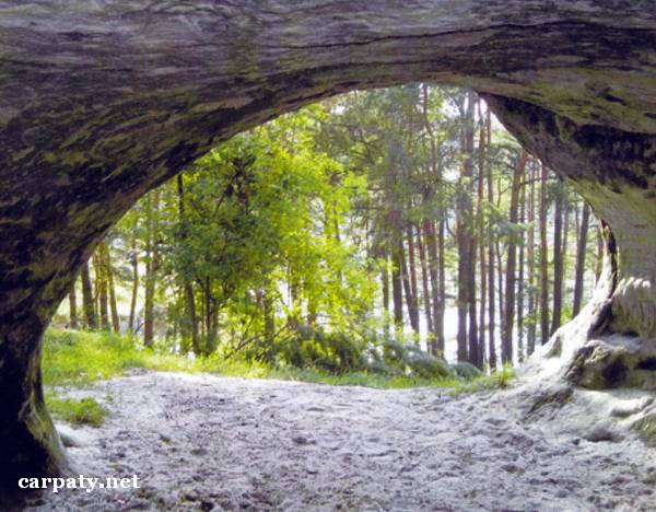
LVIV REGION. STRADCHANSKA CAVE.
GEOLOGICAL LANDMARKS OF UKRAINE. LVIV REGION.
Volyno-Podilska Plate
Yavorivskiy area, Stradch village, north-western outskirt
49° 54′ N lat.; 23° 46′ E long.
Cave. Square 4 hectares
Geomorphologic
The cave is located on the slope of one hill at southern margin of Roztochchya in the sequence of light-grey diverse-grained sandstones of Badenian regio-stage (Middle Miocene, Opilska Suite, 14 Ma). Like the hill where the church is built the cave is also called Tserkovna (Church Cave).
The cave is horizontal and is clearly related to the layer of weakly-cemented sandstones. Full length of the cave gallery is not determined due to stone fallings. Two grottoes are known there. The first one is rectangular, 30 m2 by square and 2.2 high, with cylinder crest. The second one is round-shaped up to 3 m in diameter, with bays and galleries bifurcating in two directions.
According to the legend in one of Tatar-Mongol invasion the cave was the site of local people storage which were sentenced to be punished. The name Stradch came from this event and means “Punish”.
At present the cave and surrounding impressive landscape are the favorite place of the local’s relaxation.
Ecological conditions are suitable.
Access by motor road Lviv-Yavoriv to the village.
Legally the object is defined as local-rank landmark since 1970.
Sourсe: Geological Landmarks of Ukraine: In 3 volumes/V.P. Bezvynniy, S.V. Biletski, O.B. Bobrovetal.; V.l. Kalinin, D.S. Gurskiy, I.V. Antakova, Eds. — K.: DIA, 2006. — Volume I. — 320 p.


Comment