ROCK SALT OUTCROPS.
GEOLOGICAL LANDMARKS OF UKRAINE. TRANS-CARPATHIAN REGION.


Trans-Carpathian internal trough, Solotvynska depression
Tyachiv area, western outskirt of Solotvyno Township
47° 57′ 43” N lat.; 23° 51′ 15″ E long.
Square of the karst field 15 hectares
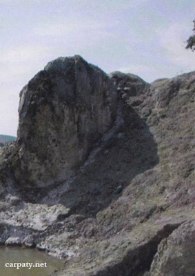
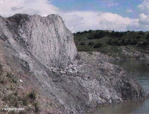
Cliff in the karst field
Geomorphologic, mineralogical.
At the western outskirt of Solotvyno township on the right bank of Tysa River in Zaton gully there occurs landscape area with enigmatic relief which appeared over salt dome (stock) due to extensive salt karst processes. The outcrop looks as small cliff up to 5 m in height (remnants of the diapir roof) composed of crystalline stone salt (halite). The diapir cut Late Badenian sediments in the weak zone of large fault. Due to diapiric structure uplift the third Tysa River terrace is deformed that caused hilly-depression karst relief with formation of subsided small lakes with salt water and fine landslides. Salt stock and productive salt-bearing pile of Upper Tereblyanska Sub-Suite (Middle Badenian) is being mined by Solotvynskiy salt mine.
Ecological conditions are suitable.
Accessible by motor-car. 600 m to the south-west form church in Solotvyno Township.
Legally the object as geological landmark is not defined yet.
It is suggested to give the status of geological international-rank landmark.
Sourсe: Geological Landmarks of Ukraine: In 3 volumes/V.P. Bezvynniy, S.V. Biletski, O.B. Bobrovetal.; V.l. Kalinin, D.S. Gurskiy, I.V. Antakova, Eds. — K.: DIA, 2006. — Volume I. — 320 p.
Comment