LVIV REGION. URYTSKI CLIFFS.
GEOLOGICAL LANDMARKS OF UKRAINE. LVIV REGION.

External Carpathians, Skyboviy Nappe
Skole area, north-western outskirt of Urych village. Valley of Urychanka River
49° 11′ N lat.; 23° 25′ E long.
Cliffs. Square 5 hectares
Geomorphologic.
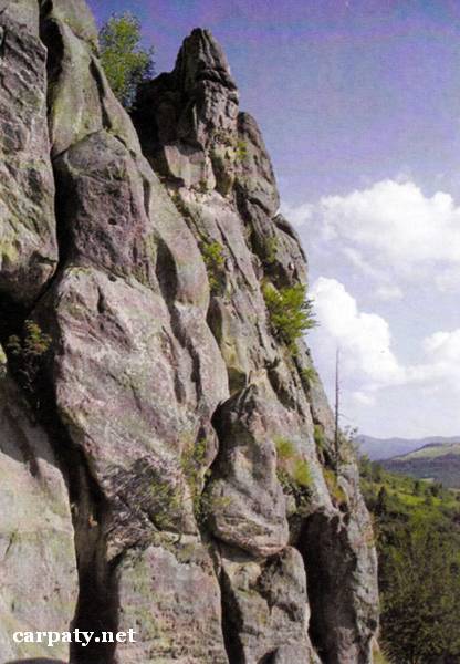
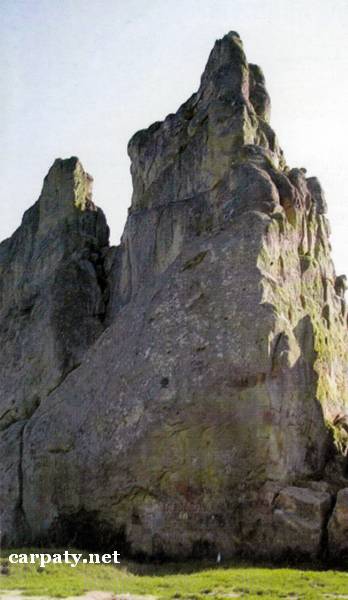
The Urytski Cliffs up to 50 m high do form wonderful complex on the left slope of Urychanka River valley. These are erosion remnants of massive and layered sandstones of Yamnenska Suite (Upper Paleocene, 55 Ma). On the cliffs somewhere there are preserved remnants of the walls and constructions which on archeologists thoughts comprise the remnants of ancient Rus fort Tustan (XI—XIII centuries). There are man-made caves, tunnels and draw-wells inside cliffs. The cliffs make landscape impressive and attractive for numerous tourists.
Ecological conditions are suitable.
There is dirt road from Urych village to the cliffs.
Legally the object is defined and.included into the National Nature Park “Skole Beskydy” and historic-landscape complex “Tustan”.
It is suggested to give the status of international-rank landmark.

Sourсe: Geological Landmarks of Ukraine: In 3 volumes/V.P. Bezvynniy, S.V. Biletski, O.B. Bobrovetal.; V.l. Kalinin, D.S. Gurskiy, I.V. Antakova, Eds. — K.: DIA, 2006. — Volume I. — 320 p.

Comment