LVIV REGION. CHORTOVA SKELYA.
GEOLOGICAL LANDMARKS OF UKRAINE. LVIV REGION.

Volyno-Podilska Plate
Lviv city, eastern outskirt
49° 49’ N lat.; 25° 07’ E long.
Cliffs. Square 10 hectares
Geomorphologic
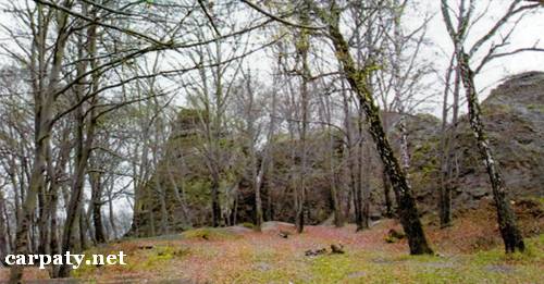
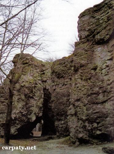
Chortova Skelya (Devil Cliff) of 414 m absolute height bounds south-eastern margin of Lvivske Plateau. Flat-top erosion remnant is capped with distinct (chimerical) weathering forms of Upper Badenian sandstones (Middle Miocene, Kayzervaldski Layers, 14 Ma). These are tower-like cliffs up to 20 m high. Oblique banding is clearly expressed in the calcareous sandstones of various density.
The cliffs are landscape impressive decoration. This is typical example of erosion remnants. On the mountain slopes also clearly expressed suffusion karst funnels and slides. This is an object of tourist relaxation and training for climbing of Lviv citizens. It also has historical importance since in time of Galytch Volyn princedom guard check-points were located there. This is why the cliff is also called Chatova, that is, Guard.
Access by motor way then by passes marked by tourist signs.
Legally the object is defined as local-rank forest reserve since 1984.
Sourсe: Geological Landmarks of Ukraine: In 3 volumes/V.P. Bezvynniy, S.V. Biletski, O.B. Bobrovetal.; V.l. Kalinin, D.S. Gurskiy, I.V. Antakova, Eds. — K.: DIA, 2006. — Volume I. — 320 p.


Comment