IVANO-FRANKIVSK REGION. SOKILSKA CLIFF.
GEOLOGICAL LANDMARKS OF UKRAINE. IVANO-FRANKIVSK REGION.
Fore-Carpathian Trough, Boryslavsko-Pokutskiy Thrust
Kosiv area, Velykiy Rozhen village. Left gullied slope of Cheremosh River valley
48° 14′ N lat.; 25° 06′ E long.
Cliffs. Square 1,5 hectares
Stratigraphic, geomorphologic.
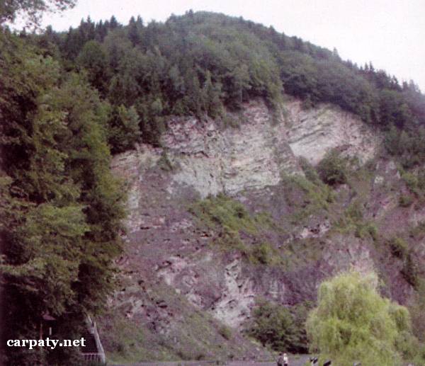
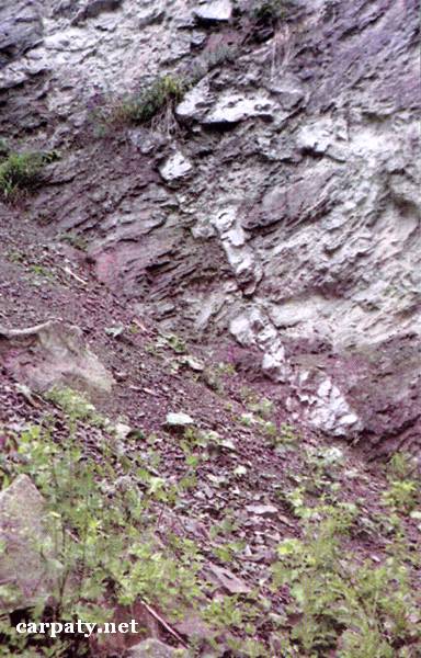
There are rocky cliffs up to 50-70 m high along distance 250 m. The lower part of outcrop is comprised of Upper Paleocene massive sandstones (Yamnenska Suite, Montian-Tanetian regio-divisions, 55 Ma). Up by the section there occurs a pile of green-colored thin-rhythmic Lower Eocene flysch (Manyavska Suite, Iprian regional-division, 50 Ma) and a pile of Middle Eocene platy silicified aleurolites (Vygodska Suite, Lutetian-Bartonian regio-divisions, 45 Ma). The section is finished with Upper Eocene green argillites (Bystrytska Suite, Bartonian-Pryabonian regional-divisions, 40 Ma). Total thickness of the Eocene rocks in this section is about 110m. Fractures of gravitation origin in Vygodska Suite rocks are filled up with neptunic dykes of diverse-grained sandstone up to 20 cm thick and first meters long.
In the object there are exposed flysch sediments that are characteristic for Boryslavsko-Pokutskiy Thrust which in the south-west form a range of anticline folds uplifted to the surface (so called “Pokutski folds”). Besides this the cliff is essential landscape decoration. Close to the rocky outcrop small stream gives the waterfall above which in 1990 there was established the monument in honor of Taras Shevchenko. Altogether this looks attractive for tourists.
Ecological conditions are suitable.
Object is located close to motor way Vyzhnytsya-Putyla.
Legally the object as geological landmark is not defined yet. it is suggested to give the status of local-rank landmark.
Sourсe: Geological Landmarks of Ukraine: In 3 volumes/V.P. Bezvynniy, S.V. Biletski, O.B. Bobrovetal.; V.l. Kalinin, D.S. Gurskiy, I.V. Antakova, Eds. — K.: DIA, 2006. — Volume I. — 320 p.


Comment