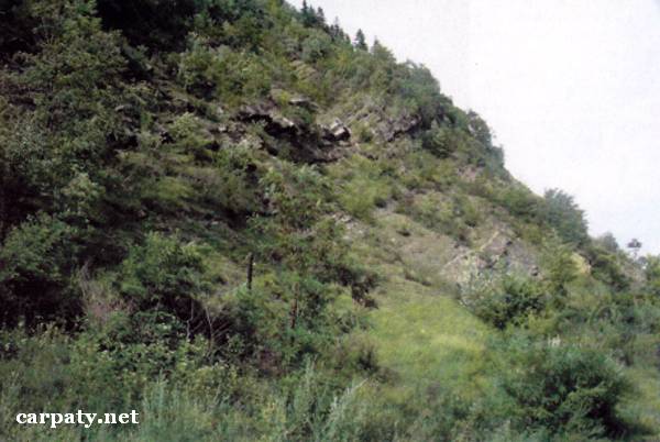
IVANO-FRANKIVSK REGION. KOUTSKE OUTCROP OF UPPER CRETACEOUS — LOWER PALEOGENE FLYSCH.
GEOLOGICAL LANDMARKS OF UKRAINE. IVANO-FRANKIVSK REGION.

Fore-Carpathian Trough, Boryslavsko-Pokutskiy Thrust
Kosiv area, south-western outskirt of Kouty village. Left gullied slope of Cheremosh River valley
48° 15′ N lat; 25° 09′ E long.
Square 5 hectares
Stratigraphic.
There is an outcrop up to 50 m high in gullied slope of the river valley. The section includes thin-rhythmic intercalation of grey sandstones, aleurolites and argillites of Striyska Suite (Maastricht and Dathian divisions, 65-70 Ma). On the aleurolite footwall bedding planes there occur numerous bioglyphs (worn paths) and in sandstone layers occur gradual bedding (Bowme textures) that is characteristic for the flysch sediments.
The object is a characteristic example of typical Late Cretaceous two-component thin-rhythmic flysch section. Besides this the outcrop is an impressive landscape decoration and the object for geological excursions.
Ecological conditions are suitable.
Object is located close to motor way Vyzhnytsya-Putyla.
Legally the object as geological landmark is not defined yet. It is suggested to give the status of local-rank landmark.
Sourсe: Geological Landmarks of Ukraine: In 3 volumes/V.P. Bezvynniy, S.V. Biletski, O.B. Bobrovetal.; V.l. Kalinin, D.S. Gurskiy, I.V. Antakova, Eds. — K.: DIA, 2006. — Volume I. — 320 p.
Comment