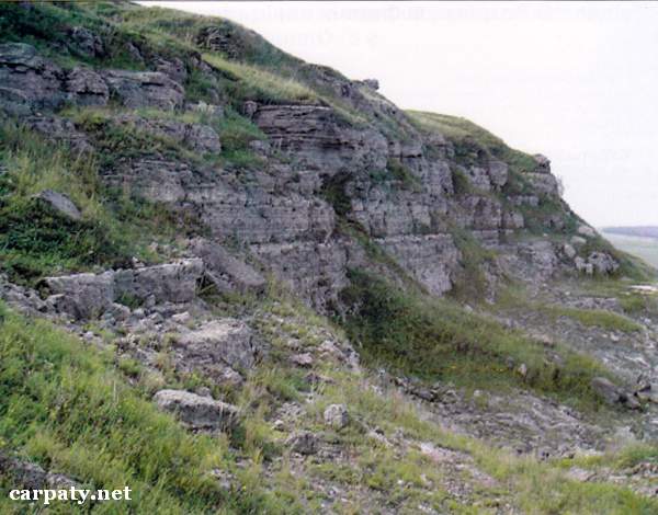
IVANO-FRANKIVSK REGION. CROSS-SECTION OF SULPHATE ROCKS OF TYRASKA SUITE IN OTESHIV VILLAGE.
GEOLOGICAL LANDMARKS OF UKRAINE. IVANO-FRANKIVSK REGION.
Volyno-Podilska Plate
Tlumatskiy area, Oleshiv village. Right rocky bank of Tlumach Stream valley 48°56′ N lat; 25°00′ E long.
Rocky cliffs up to 20 m high and closed quarry. Square 5 hectares
Stratigraphic.
At the section bottom occur giant-grained gypsum aggregates which essentially undergone secondary alteration (dehydration and repeated hydration). They are overlain by fine-grained gypsum with characteristic stromatolite texture. Higher there occurs interlayering of fine-grained and coarse-grained gypsum and then giant-grained gypsum with characteristic sable-like crystal shape. The section is finished with fine-grained gypsum and gupsum breccias resulted from early-formed gypsum erosion and redeposition (so called “sedimentary cannibalism”). Total thickness of the section is about 40 m.
This is most complete section of sulphate rocks of Upper Badenian (Upper Miocene, 15 Ma) Tyraska Suite in the Ukrainian Fore-Carpathian, and the object for geological excursions.
Ecological conditions are suitable.
Accessible by walk along pass from eastern outskirt of Oleshiv village.
Legally the object as geological landmark is not defined yet.
It is suggested to give the status of geological regional-rank landmark.
Sourсe: Geological Landmarks of Ukraine: In 3 volumes/V.P. Bezvynniy, S.V. Biletski, O.B. Bobrovetal.; V.l. Kalinin, D.S. Gurskiy, I.V. Antakova, Eds. — K.: DIA, 2006. — Volume I. — 320 p.

Comment