RADVANSKE ANDESITE OUTCROP.
GEOLOGICAL LANDMARKS OF UKRAINE. TRANS-CARPATHIAN REGION.
Trans-Carpathian internal trough, Vygorlat-Gutynske volcanic range
Uzhgorod city, eastern outskirt (“Radvanka”)
48° 36′ 45″ N lat; 22° 19′ 40″ E long.
Square 5 hectares; Quarry
Magmatic.
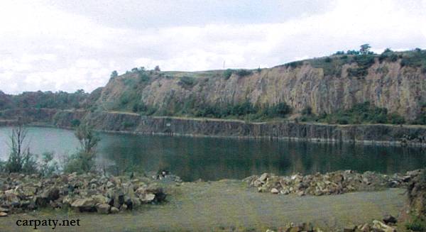
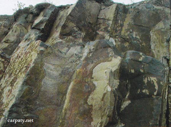
At the eastern outskirt of Uzhgorod city in the closed and flooded Radvanskiy quarry and in the surrounding locations Late Sarmatian-Pannonian (absolute age ~ 11.5 Ma) andesite lavas are fairly exposed. Andesites are dark-coloured and black, display coarse-columnar jointing and sometimes fluidal texture. Total height of exposure benches attains tens of meters. Along the jointing planes in the weathered crust, there appear enigmatic scripts caused by deviations and shifting of semi-chilled lava primary fluid strips. Andesites form volcanic dome created at the early stage of Vygorlat-Gutynske volcanic ridge development that provides the interest for geologists.
Bottom portion of the quarry is flooded and comprise beautiful lake that attracts tourists and nature-fanciers being favorite rest-place of the Uzhgorod citizens.
Ecological conditions are suitable.
Accessible by motor-car, 500 m eastward from the church.
Legally the object as geological landmark is not defined yet.
It is suggested to give the status of geological regional-rank landmark.
Sourсe: Geological Landmarks of Ukraine: In 3 volumes/V.P. Bezvynniy, S.V. Biletski, O.B. Bobrovetal.; V.l. Kalinin, D.S. Gurskiy, I.V. Antakova, Eds. — K.: DIA, 2006. — Volume I. — 320 p.


Comment