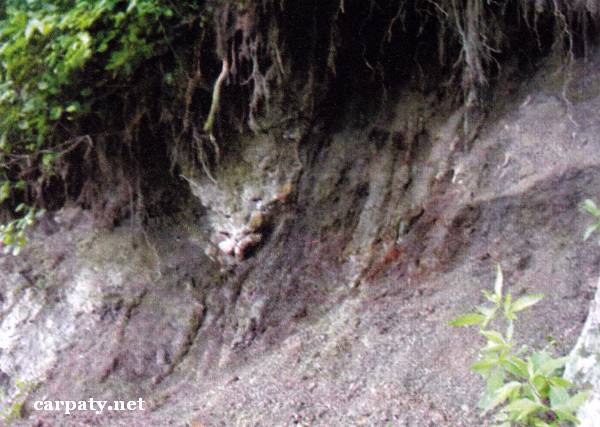
IVANO-FRANKIVSK REGION. CONTACT OF F LYSCH AND MOLASSA ROCKS OF BORYSLAVSKO-POKUTSKIY THRUST.
GEOLOGICAL LANDMARKS OF UKRAINE. IVANO-FRANKIVSK REGION.
Fore-Carpathian Trough, Boryslavsko-Pokutskiy Thrust
Kolomiya area, Lyucha village. Right slope of Lyuchka River valley
48° 24′ N lat.; 24° 54′ E long.
Square 1 hectare.
Stratigraphic.
There are right gullied river slope and benches in the course along 10 m. On the eroded surface of the Lower Flint Horizon and pile of Ombronskiy regio-division (25-30 Ma) Lower Menilitova Sub-Suite black argillites there lies the pile of Eger-Egenburg regio-divisions (20-25 Ma) Vorotyshchenska Suite Slobidski conglomerates, at the lower part of which there occur olistolites composed of clasts of Menilitova Suite black argillites. In the left bank of river valley along the distance of 10 m there exposed fine-clastic salted conglomerates (this is the only place where conglomerates are salted).
The object is of stratigraphic importance for solution of disputable questions concerning relationships between structures of Boryslavsko-Pokutskiy Thrust.
Ecological conditions are suitable.
From Kolomiya Town there is motor way through Yabluniv village to Dilyatyn village. From the road to object walk pass 200 m long.
Legally the object as geological landmark is not defined yet.
It is suggested to give the status of regional-rank landmark.
Sourсe: Geological Landmarks of Ukraine: In 3 volumes/V.P. Bezvynniy, S.V. Biletski, O.B. Bobrovetal.; V.l. Kalinin, D.S. Gurskiy, I.V. Antakova, Eds. — K.: DIA, 2006. — Volume I. — 320 p.

Comment