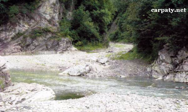
IVANO-FRANKIVSK REGION. LOWER MIOCENE OLISTOSTROMES.
GEOLOGICAL LANDMARKS OF UKRAINE. IVANO-FRANKIVSK REGION.

Fore-Carpathian Trough, Boryslavsko-Pokutskiy Thrust
Kolomiya area, south-western outskirt of Pistyn village. Pistynka River
48°21′ N lat.; 25°01′ E long.
Square 1,6 hectares
Stratigraphic, geomorphologic.
There are rocky cliffs in both river banks over 200 m distance.
In both river banks there are exposed large (30-40 m) olistolites composed of Carpathian Eocene and Oligocene (35-40 Ma) rocks which occur within Lower Miocene (Eger-Egenburg regio-divisions (20-25 Ma), Vorotyshchenska Suite) green conglomerates. Entire sequence well exemplifies Lower Miocene olistostrome.
This object is of principal importance for studies of relationships between Oligocene and Miocene rocks in Boryslavsko-Pokutskiy Thrust. It is also impressive decoration of the local landscape. Ecological conditions are suitable.
Access from the motor way to Kosmach village by the street in Pistyn village through bridge over river to the church on the right bank.
Legally the object as geological landmark is not defined yet. It is suggested to give the status of local-rank landmark.
Sourсe: Geological Landmarks of Ukraine: In 3 volumes/V.P. Bezvynniy, S.V. Biletski, O.B. Bobrovetal.; V.l. Kalinin, D.S. Gurskiy, I.V. Antakova, Eds. — K.: DIA, 2006. — Volume I. — 320 p.
Comment