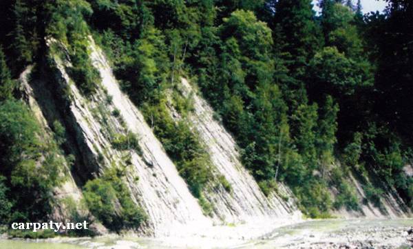
IVANO-FRANKIVSK REGION. CLIFF IN THE TATARIV VILLAGE.
GEOLOGICAL LANDMARKS OF UKRAINE. IVANO-FRANKIVSK REGION.

External Carpathians, Skyboviy Nappe,
Nadvirna area, centre of Tatariv village. Right rocky slope of Prut River valley
48° 21′ N lat; 24° 35′ Elong.
Square 1 hectare.
Stratigraphic, geomorphologic.
There are rocky cliff up to 20 m high and benches in the river course along 10 m distance. Lower Flint Horizon section (Oligocene Lower Menilite Sub-Suite, 25-35 Ma) includes fine-rhythmic alternation of thin-platy black flints and silicified ash-grey marls. Horizon thickness is 8 m. Below there occurs a pile of black ar-gillites up to 10 m thick which is still of Oligocene age, and then pile of greenish-gray thin-platy argillites of Upper Eocene (40 Ma) Bystrytska Suite. Rock dipping is monocline by azimuth 220° and 45° dip angle.
There is clear contact of Upper Eocene and Lower Oligocene rocks in the Skolivska Nappe of Skyboviy Thrust. It is of stratigraphic importance and also impressive local landscape decoration.
Ecological conditions are suitable.
From the motor way Ivano-Frankivsk — Rakhiv in the village centre there is walk pass 50 m long to the cliff.
Legally the object as geological landmark is not defined yet. It is suggested to give the status of local-rank landmark.
Sourсe: Geological Landmarks of Ukraine: In 3 volumes/V.P. Bezvynniy, S.V. Biletski, O.B. Bobrovetal.; V.l. Kalinin, D.S. Gurskiy, I.V. Antakova, Eds. — K.: DIA, 2006. — Volume I. — 320 p.
Comment