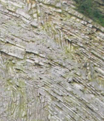
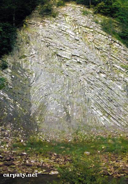
IVANO-FRANKIVSK REGION. GOTHIC FOLDS.
GEOLOGICAL LANDMARKS OF UKRAINE. IVANO-FRANKIVSK REGION.
External Carpathians, Skyboviy Nappe,
Nadvirna area, centre of Yaremcha Town. Right gullied slope of Prut River
48′ 27′ N lat; 24° 34′ E long.
Carpathian National Nature Park
Tectonic, stratigraphic.
The rocky bank of Prut River is up to 100 m high along distance of 350 m.
The sequence comprises fine-rhythmic three-component flysch of Striyska Suite (Upper Cretaceous — Lower Paleocene, 60-75 Ma). The rocks make up the front portion of Orivskiy nappe of the Skyboviy Thrust and are deformed into vertical with slight north-east deviation gothic folds with limb range of 5-10 m. The folds are resulted from the side tension and rock horizontal displacement northward during Carpathian mega-thrust formation and are complicated with numerous low-altitude faults.
This is typical for External Carpathians section of flysch rocks deformed into classical folds of gothic type. It makes impressive landscape decoration, is included to the program of geological excursions of Carpathian-Balkanian Geological Association and also attracts numerous tourist and students of local lore.
Ecological conditions are suitable.
Up to Yaremcha town there is l-class motor-car road from which access by street to the left river bank where outcrop becomes visible. Part of the outcrop is also quite visible from the road.
Legally the object as geological landmark is defined and Included Into Carpathian National Nature Park since 1980.
It is suggested to give the status of geological state-rank landmark.
Sourсe: Geological Landmarks of Ukraine: In 3 volumes/V.P. Bezvynniy, S.V. Biletski, O.B. Bobrovetal.; V.l. Kalinin, D.S. Gurskiy, I.V. Antakova, Eds. — K.: DIA, 2006. — Volume I. — 320 p.


Comment