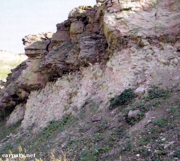
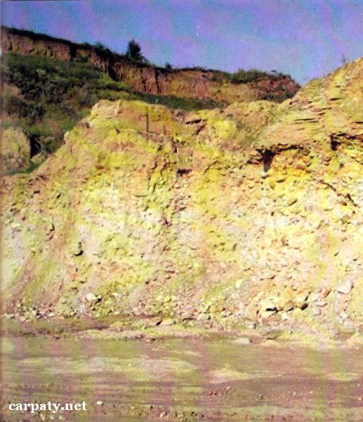
IVANO-FRANKIVSK REGION. CROSS-SECTION OF CRETACEOUS, MIDDLE MIOCENE AND PLEISTOCENE SEDIMENTS IN STRILCHE VILLAGE.
GEOLOGICAL LANDMARKS OF UKRAINE. IVANO-FRANKIVSK REGION.
Volyno-Podilska Plate
Gorodenkivskiy area, Strilche village
48° 42′ N lat.; 25° 30′ E long.
Quarry. Square 3 hectares
Stratigraphic.
In the quarry wall along 20 m distance there occurs the coarse-block conglomerate pile of transitional from Early to Late Cretaceous age. Well-rounded clast material is composed of Lower Devonian Dnister Series sandstone blocks. Thickness of conglomerates is about 10 m. They are overlain by Upper Cretaceous Senomanian sandy limestones (Kasperovetska Suite, 100 Ma) up to 4 m thick. On the eroded surface of limestones there lie Miocene green clays (Carpathian regio-division, Berezhanski and Oncophore layers, 18 Ma) up to 1.8 m thick. Eroded clay surface in turn is overlain by Lower Badenian reddish limestones (Opilska Suite, 16 Ma) of 18 m thick. Then on the eroded limestone surface there lies Upper Badenian sulphate pile (Tyraska Suite, 14 Ma). The section is finished (in quarry) with thick (up to 15 m) pile of sub-aeral sediments (soils and loess-like loams) where several Middle-Late Pleistocene climate layers are clearly distinguished.
This is a section of Podolian Lower-to-Upper Cretaceous sediments which reflects sedimentation paleo-geographic situation in this region. Ecological conditions are suitable.
Accessible by motor-car road from Gorodenka City.
Legally the object as geological landmark is not defined yet.
It is suggested to give the status of geological local-rank landmark.
Sourсe: Geological Landmarks of Ukraine: In 3 volumes/V.P. Bezvynniy, S.V. Biletski, O.B. Bobrovetal.; V.l. Kalinin, D.S. Gurskiy, I.V. Antakova, Eds. — K.: DIA, 2006. — Volume I. — 320 p.


Comment