CHERVONA SKELYA (“RED CLIFF”) STREAM.
GEOLOGICAL LANDMARKS OF UKRAINE. TRANS-CARPATHIAN REGION.


Trans-Carpathian internal trough, Vygorlat-Gutynske volcanic range
Khust area, western outskirt of Khust city. Right bank of Rika River
48°” 10′ 57″ N lat; 23° 16′ 05″ E long.
Cliff
Magmatic, geomorphologic.
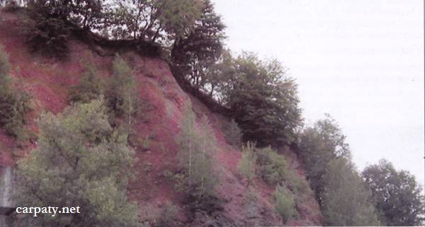
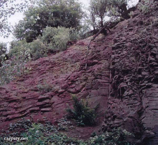
At the eastern outskirt of Khust city in erosion cliff remnant which is called “Chervona Skelya” (“Red Cliff”) there are exposed andesites overlapped by agglomerate andesite tuffs (Late Sarmatian-Pannonian). Rocky cliff is about 15 m high and up to 100 m long. Due to extensive iron mineralization the rocks (especially tuffs) are bright-red colored and comprise typical weathered crust. At this place it is preserved from erosion breakdown because of low-energy relief and lack of destroying water streams.
Chervona Skelya is accompanied by sad legend which tells that in ancient times the local lord Khust ones mistakenly considered his son as Tatar enemy and killed him at this place. And when he then recognized his son in the killed man he was so distraught with grief that made suicide. Thus blood of father and son covered the cliff.
This is the only outcrop in Trans-Carpathian where typical and thick weathered crust is preserved from erosion.
Ecological conditions are suitable.
Accessible by motor-car ‒ northward from the road bridge Vynogradiv – Khust.
Legally the object as geological landmark is not defined yet.
It is suggested to give the status of geological regional-rank landmark.
Sourсe: Geological Landmarks of Ukraine: In 3 volumes/V.P. Bezvynniy, S.V. Biletski, O.B. Bobrovetal.; V.l. Kalinin, D.S. Gurskiy, I.V. Antakova, Eds. — K.: DIA, 2006. — Volume I. — 320 p.
Comment